
Drone Flux Measurement (DFM™)

A new highly accurate drone-based method of measuring fugitive climate gases from different sources.

Scalable emissions measurement for complex sites

The DFM™ Method, developed and patented by Explicit, offers a highly accurate, drone-based approach for measuring fugitive gases from various critical sources.

Based on an advanced sensor and sampling design, the method enables the quantification of individual site and source-level contributions, as well as flare destruction removal efficiency estimations in compliance with OGMP 2.0 guidelines and aligned with the EU Methane Regulation.

Key benefits

Multiple measurements with a single payload
Fully measured data, no reliance on models
Real-time data displayed on the pilot’s RC
Emission reports within 24-48 hrs of survey
Visualisations to support source localisation
Patented, ISO-17025 accredited method
High accuracy and low detection limit
Independence from the mean wind

From climate gases to emissions result

By combining sensors, software, and emissions expertise into a single integrated solution, Explicit provides a full ISO 17025-compliant service.

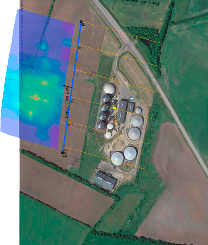
Map of emission sources plotted for drone flight planning during DFM™ Method
Preliminary site survey and sampling plan

The site is assessed to identify potential emission sources, risk zones, and feasible flight paths. A tailored sampling plan is then developed to ensure efficient and reliable data collection.
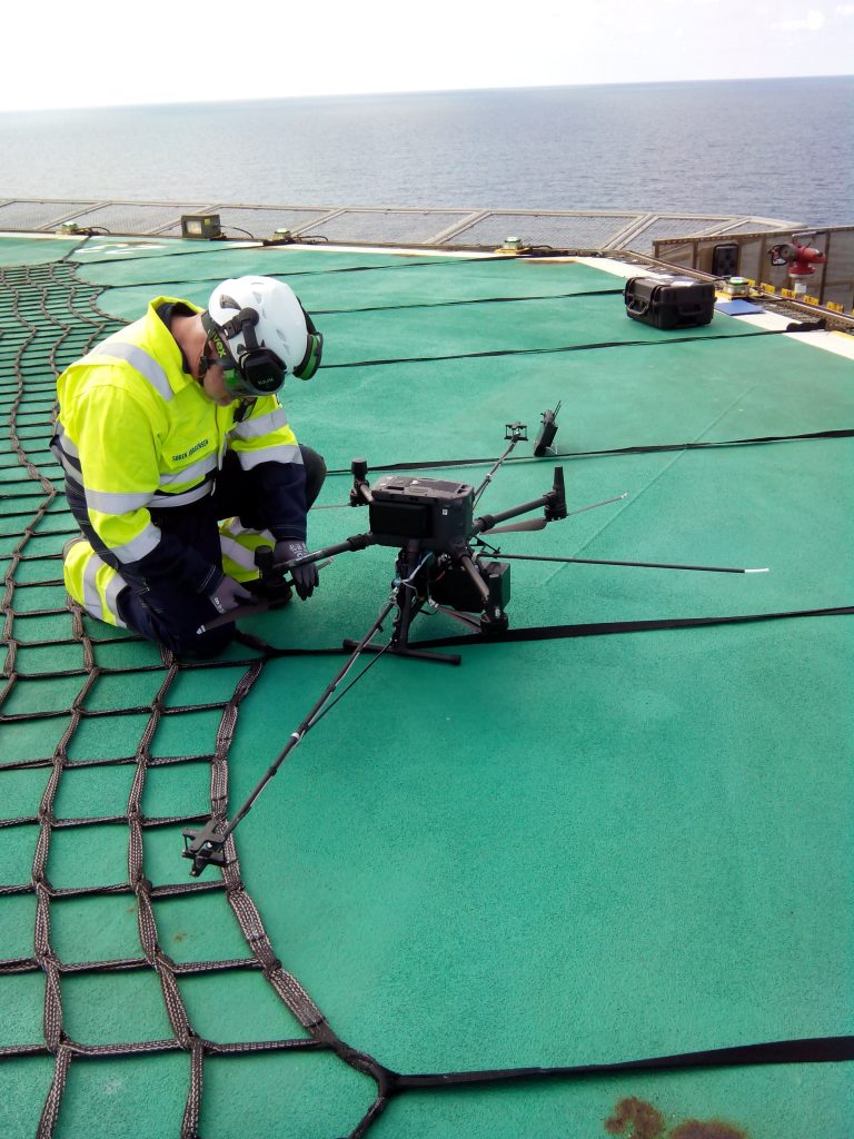
Explicit team member setting up a drone for greenhouse gas data collection using the DFM™ Method
Drone setup and data collection

Gas and wind sensors are integrated with the drone before flight. Using an adaptive flight pattern, the drone flies a vertical wall downwind from the site of interest, collecting thousands of data points.
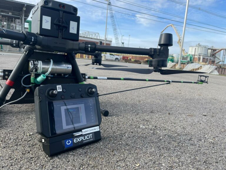
Explicit drone and remote controller displaying emissions data insights during DFM™ Method analysis
Data processing and final analysis

Automated analysis is provided to the pilot with real-time flight feedback. Once data collection is complete, analysts process and validate the measurements to quantify emissions.
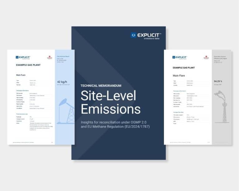
Mockup of an Explicit emissions report
Emissions report and reconciliation insights

A comprehensive report is presented to the client with quantified emission rates, key findings, and visualisations that support source localisation and informed decision-making.
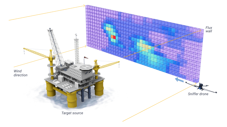
Conceptual illustration of aerial drone survey with greenhouse gas emission plumes visualised using the DFM™ Method

Quantification of emisisons

Data is collected downwind from the site of interest, so that the emission plume is entirely intercepted by the drone.

Since both gas and wind data are closely correlated in time and space, Explicit can accurately calculate the net emission rate (kg/h) across the inspected area and provide a consistent representation of the gas flux density flowing from the site.

Industries and applications

Oil and gas platforms

Measure methane emissions from offshore and onshore production, including flares, fugitive leaks, and super-emitting sources.

Wastewater treatment plants

Quantify nitrous oxide emissions from treatment processes, including areas that are difficult to monitor over water.

Biogas plants

Quantify methane emissions from biogas plants and refineries to identify emissions from key process units and infrastructure.

LNG Bunkering

Monitor methane emissions during LNG bunkering operations to detect leaks and verify emission performance.

Farming

Measure diffuse methane emissions from livestock facilities, including cattle and pig housing.

Research

Quantify greenhouse gas reductions, validate emission factors, and support research on new technologies and mitigation strategies.

Data visualisation and emissions insights

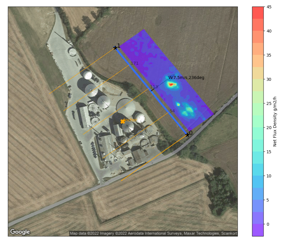
Flight flux density data are mapped onto the site layout, together with wind direction measured during the measurement campaign (orange lines).

These visualisations are included in the emissions report and help identify and localise emission sources with greater clarity.

Flux wall visualisation overlaid on a real industrial site showing greenhouse gas emission distribution measured by the DFM™ Method